Maps are more than just tools for getting from point A to point B. They are powerful creations that have shaped how people see the world. From ancient explorers to modern scientists, maps have helped change history, spark revolutions, and guide innovation. Some maps did more than show places—they shifted how humanity understood its place on Earth. These are the maps that changed the world.
Whether drawn on parchment or designed with satellites, every historic map tells a story. Some sparked wars. Others saved lives. A few opened new frontiers no one thought possible. This blog will explore the most powerful and game-changing maps ever created. You’ll discover how they influenced culture, science, and the future of the planet.
What Makes a Map World-Changing?
Not all maps make history—but a few do. What sets them apart?
To be called one of the maps that changed the world, a map must do more than guide people. It must shift ideas, break barriers, or trigger big events. These maps brought about change in science, politics, war, or discovery. Some were the first to show new continents. Others revealed secrets hidden underground. A few changed how people saw themselves and their place in the universe.
World-changing maps often appear at major turning points. They come during exploration, conflict, or innovation. They’re bold. They’re risky. And they change everything.
In the next section, we’ll look at ten of the most powerful maps ever made—each with a lasting impact that still shapes our world today.
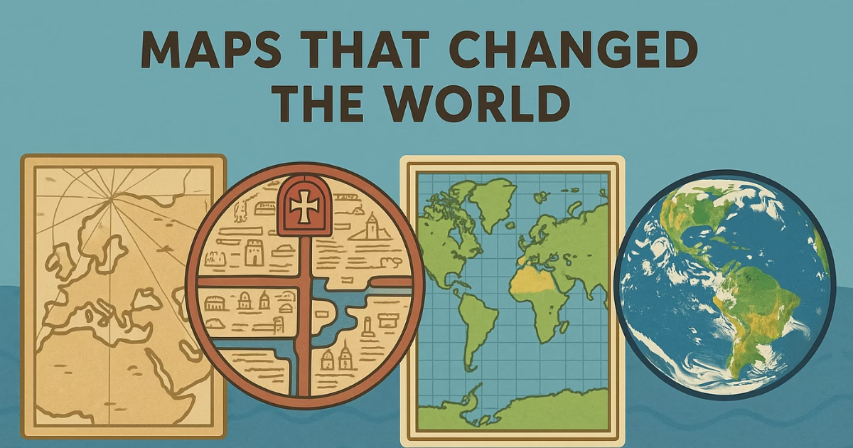
10 Maps That Changed the World Forever
1. Ptolemy’s World Map (2nd Century CE)
Claudius Ptolemy’s map was based on his book Geographia. Created in the Roman era, it became the foundation for world maps for more than 1,400 years. Even though it contained errors, such as placing Asia too close to Europe, it was groundbreaking at the time. Ptolemy introduced the concept of latitude and longitude, which modern cartographers still use today.
This map wasn’t just a drawing—it was a vision. It shaped how people in the Middle Ages understood the Earth’s geography. Later explorers like Columbus and Magellan used similar versions of it during their voyages. It’s one of the earliest examples of maps that changed the world.
2. Tabula Rogeriana by Al-Idrisi (1154)
Commissioned by a Norman king in Sicily, this Islamic map combined knowledge from both the East and West. Created by the Muslim scholar Al-Idrisi, the Tabula Rogeriana is a detailed and scientific look at the world as it was known in the 12th century.
What makes this map so important is its accuracy for its time and its cross-cultural value. It challenged European ideas and showed that knowledge didn’t come from one place. It’s a clear example of how maps that changed the world often come from unexpected sources.
3. The Hereford Mappa Mundi (c. 1300)
The Hereford Mappa Mundi is more symbolic than scientific. Created in medieval England, this map places Jerusalem at the center and includes biblical events, exotic creatures, and historical figures. It’s less about direction and more about worldview.
Still, it tells us a lot about how people thought in that time. It shaped public beliefs and supported religious and cultural ideologies. As a piece of art and philosophy, it played a key role in shaping medieval minds.
4. The Cantino Planisphere (1502)
This early map is one of the first to show the Americas after Columbus’s voyage. Smuggled from Portugal to Italy, it revealed secret information from the Age of Exploration. The Cantino Planisphere showed how valuable maps had become in the race for colonial power.
It changed the way nations approached exploration and trade. It also gave Europe a new sense of scale—and opportunity. That’s why it stands as one of the boldest maps that changed the world.
5. Waldseemüller’s Map (1507)
Martin Waldseemüller’s world map was the first to name the New World “America.” That alone makes it historically important. But there’s more to it. He created this map using updated geographical data and broke from old traditions that placed Asia and Europe at the center.
This map helped spread the idea of a truly global Earth. It made people realize that the world was bigger—and more complex—than they had imagined. Waldseemüller’s work is often called the “birth certificate of America.”
6. Mercator Projection (1569)
Gerardus Mercator designed this map for sailors. It distorted land size but made navigation easier. This map became the gold standard for sea travel for centuries.
However, its distortion also influenced how people saw the world. Countries near the equator appeared smaller, while Europe looked larger. It shaped political power and global perception. This map is still used today, making it one of the most long-lasting maps that changed the world.
7. William Smith’s Geological Map (1815)
This map changed science. William Smith, a self-taught geologist, created the first detailed geological map of England. It showed rock layers and helped predict where to find coal, iron, and other resources.
His work laid the foundation for modern geology. It also influenced mining, railroads, and construction. Simon Winchester later wrote a book about it, titled The Map That Changed the World. Few maps have had such a deep impact on science and industry.
8. John Snow’s Cholera Map (1854)
During a deadly cholera outbreak in London, Dr. John Snow used mapping to solve the mystery. By marking cases on a map, he discovered the outbreak was linked to a contaminated water pump.
His map changed medicine. It led to public health reforms and the birth of modern epidemiology. This simple map helped save lives and still influences how we track disease today. It’s a perfect example of how some maps that changed the world did so by saving lives.
9. The Blue Marble (1972)
This is not a traditional map, but a satellite image of Earth taken by Apollo 17. For the first time, people saw the whole planet clearly.
The image had a global emotional impact. It reminded people that Earth is fragile and shared. Environmental movements gained energy from it. It didn’t just show geography—it changed human perspective. That makes it one of the most important maps ever made.
10. Google Maps (2005–Present)
Google Maps changed how people travel, shop, and connect. It offers directions, real-time traffic, business reviews, and satellite images. It redefined how we use maps daily.
It also raised new issues—like privacy, digital dependency, and data collection. But no one can deny its impact. Google Maps turned an ancient tool into a high-tech experience. It’s one of the most modern maps that changed the world.
Also Read: Hidden Secrets of Mount Kailash: Mysteries You Must Know
Final Thoughts: Why Maps Will Always Matter
Maps are more than just drawings. They are records of human thought, ambition, and discovery. Some showed new continents. Others explained science. A few even saved lives. These are the maps that changed the world, not just in the past, but still today.
They helped people travel, explore, and dream. They showed power, belief, and truth. Every map on this list had a deep impact—on history, science, or the way we think.
Even today, digital maps guide our lives. They help us make choices and solve problems. From ancient parchment to satellite views, maps remain tools of change.
The world keeps evolving, but one thing stays the same—maps will always matter. And some maps, no matter how old, will always shape the world.
FAQs About Maps That Changed the World
What is the most important map in history?
There’s no single answer. Some say Ptolemy’s map. Others say the Mercator projection or William Smith’s geological map. Each changed the world in its own way.
Why did the Mercator map become so popular?
It made sea travel easier. Sailors could plot straight paths across oceans. Though it distorts land size, it became the main tool for navigation for centuries.
Who created the first modern map?
Martin Waldseemüller’s 1507 map is often called the first modern map. It was the first to label the Americas and showed a more accurate world view.
Are old maps still useful today?
Yes. Historians, scientists, and geographers use them to study changes in land, population, and thought. Some old maps still guide research and decisions.
How did John Snow’s map save lives?
He used a simple map to trace a cholera outbreak in London. His work helped change how we understand disease and led to better public health systems.